
Background
Transport poverty has long been cited as one of the key limitations for individuals and their communities to achieve their potential. In short, transport poverty (cost and time) limits access to resources, jobs, social interaction and mobility. Correspondingly, City Councils need to take account of this in the planning of infrastructure, transport systems and local interventions, such as cycle paths or fare subsidisation. However, there do not presently exist any tools that can enable councils to examine and prioritise areas of the city, and/or appraise possible interventions in a quantitative manner. This project will seek to address this deficiency through the creation of a method and model for Bristol City.
Aim
To develop a prototype method and model for evaluating denizen mobility in Bristol City based on public and free transport infrastructure (buses, bikes, walking).
Approach
- To create network maps of the bus and pedestrian access within Bristol.
- Calculate isochrones (contour lines of equal journey time) for different points in the city. These include every LSOA in the city, and the nearest service/amenity.
- Compare access to transport in deprived and less-deprived areas
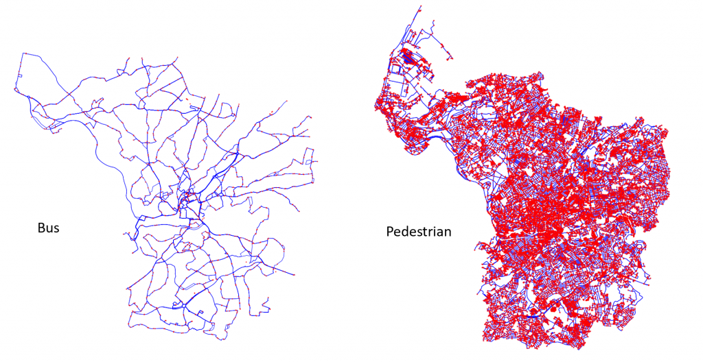
Bus and Pedestrian Network Maps 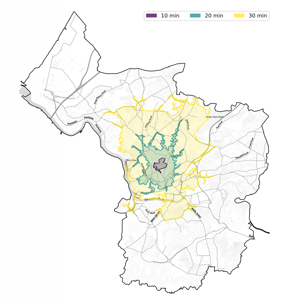
An example of isochrones of 10, 20, and 30 minutes from a point in Bristol
Output
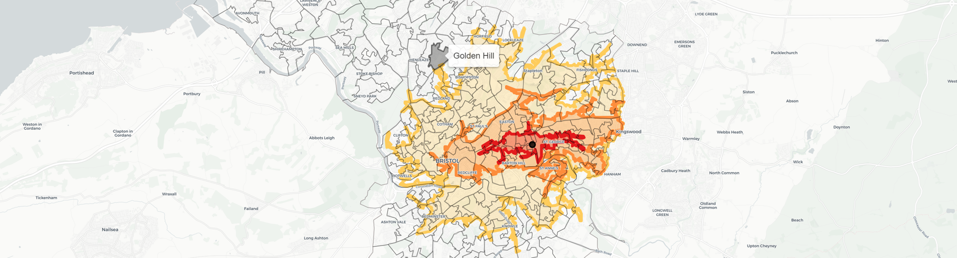
Interactive Map
Created an interactive map of the City to visualise and investigate deprivation and transport isochrones. This map can be found here.
Amenity Access
Plotted the time to get to the nearest amenities from all points in Bristol. These plots compared using and not using the bus – showing how long it would take to get to them. The amenities included: college, bank, hospital, doctor, post office, and supermarket.
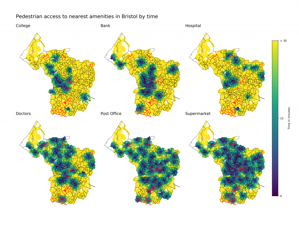
Walking access to nearest amenities 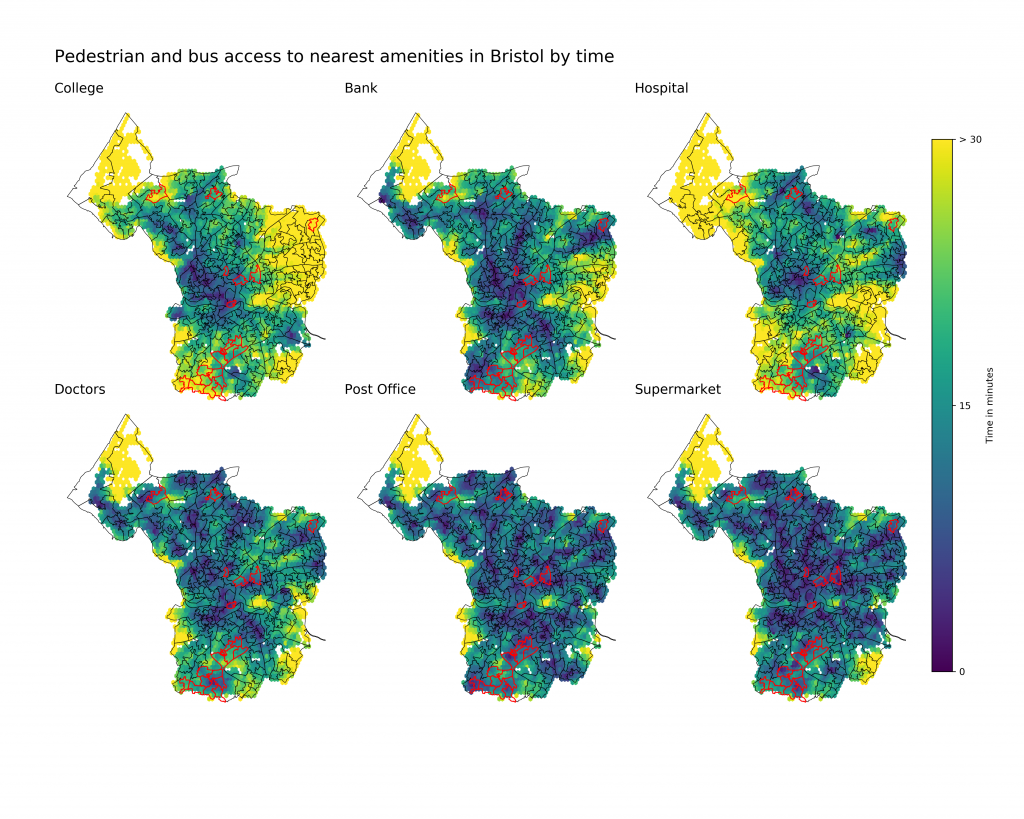
Bus and walking access to nearest amenities